This page provides step-by-step instructions for finding the largest emitter in a particular state.
Step 1. Go to the FLIGHT
When you first enter the Facility Level Information on Greenhouse Gases Tool (FLIGHT), you will be presented with two search options:
- View all U.S. Facility Data by map
View Facilities in your State
Click image to expand below


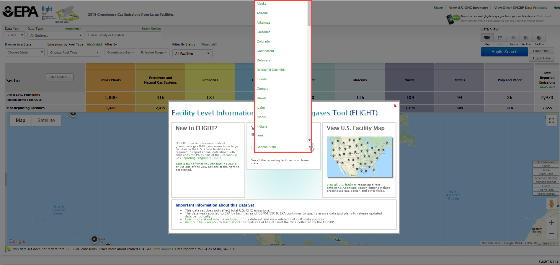
Step 2. Select a state
Use the "View Facilities in your State" search option to choose a state from the drop-down menu.
Click image to expand below

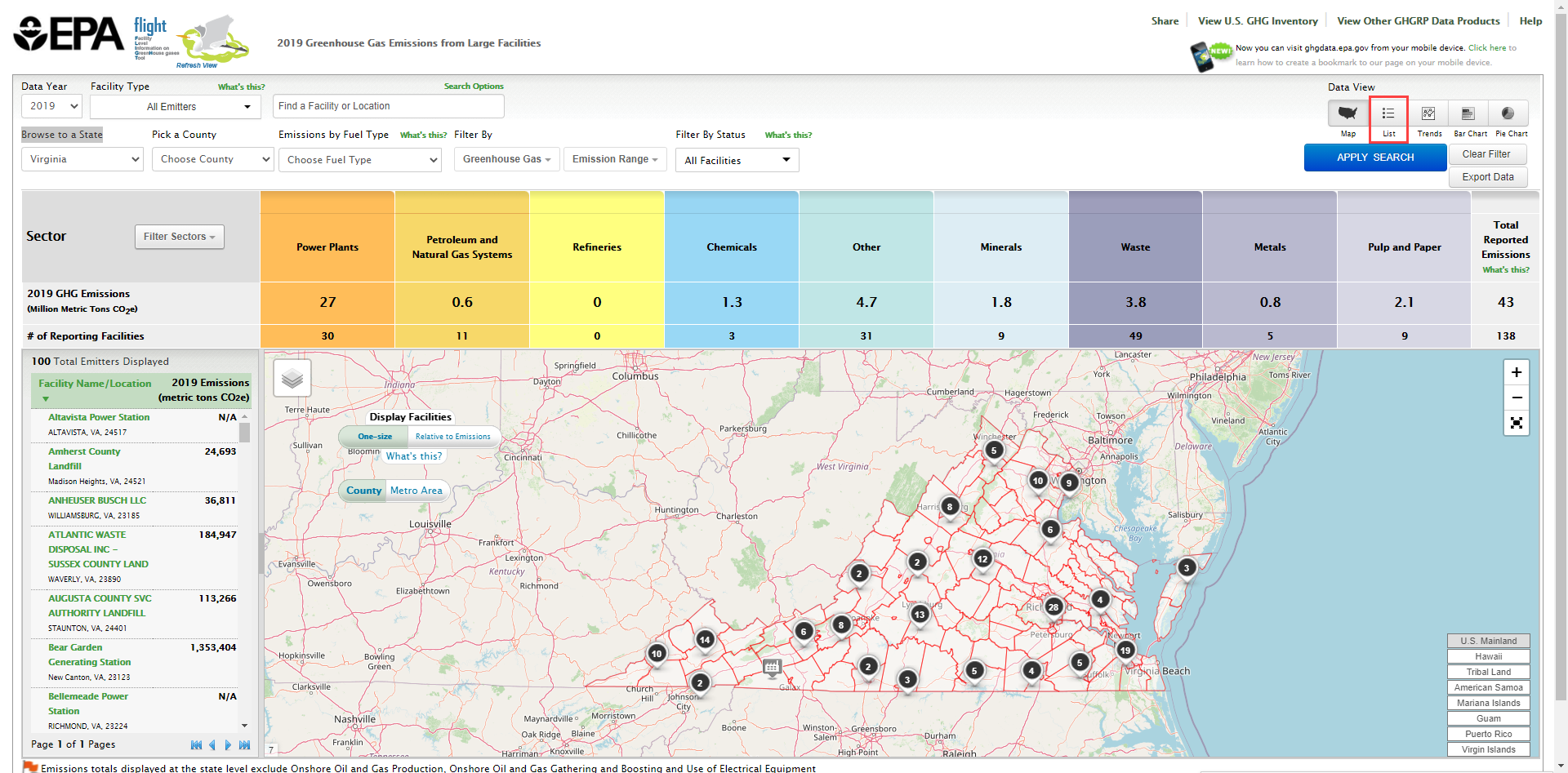
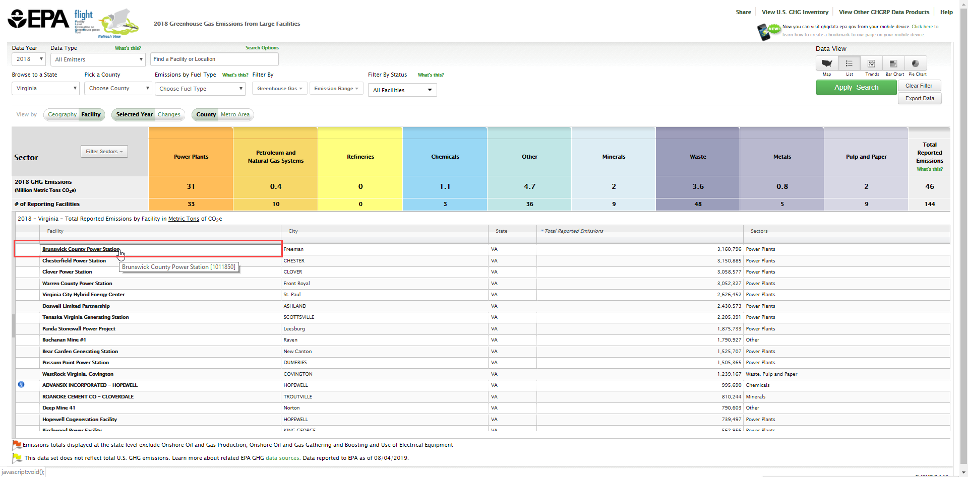
Step 3. Switch from Map View to List view (by facility)
Click the "List" button in the upper right hand corner.
Click image to expand below
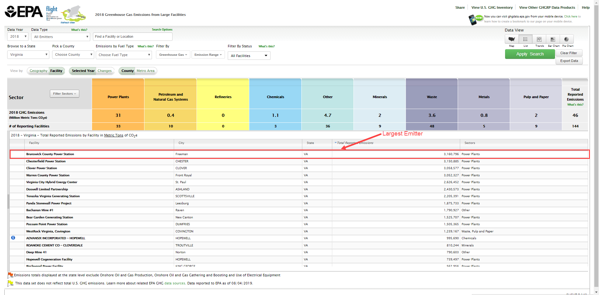
Step 4. Identify the largest emitter
Click the total reported emissions column header to sort the list. Clicking it once will sort from smallest to largest, a second time will sort from largest to smallest. The facility at the top of list is the largest emitter in the selected state.
Click image to expand below
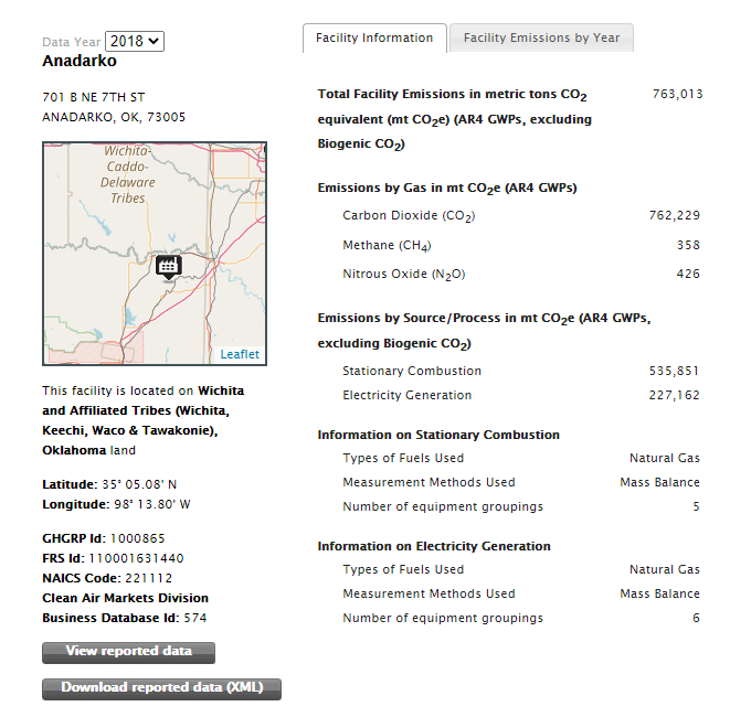
To view additional details for a facility, simply click the name of the facility in the left most column.
Click image to expand below
Then click on the facility in the listing below.
Click image to expand below